NEW URBAN PLANNING PORTAL OF THE ZARAGOZA CITY COUNCIL
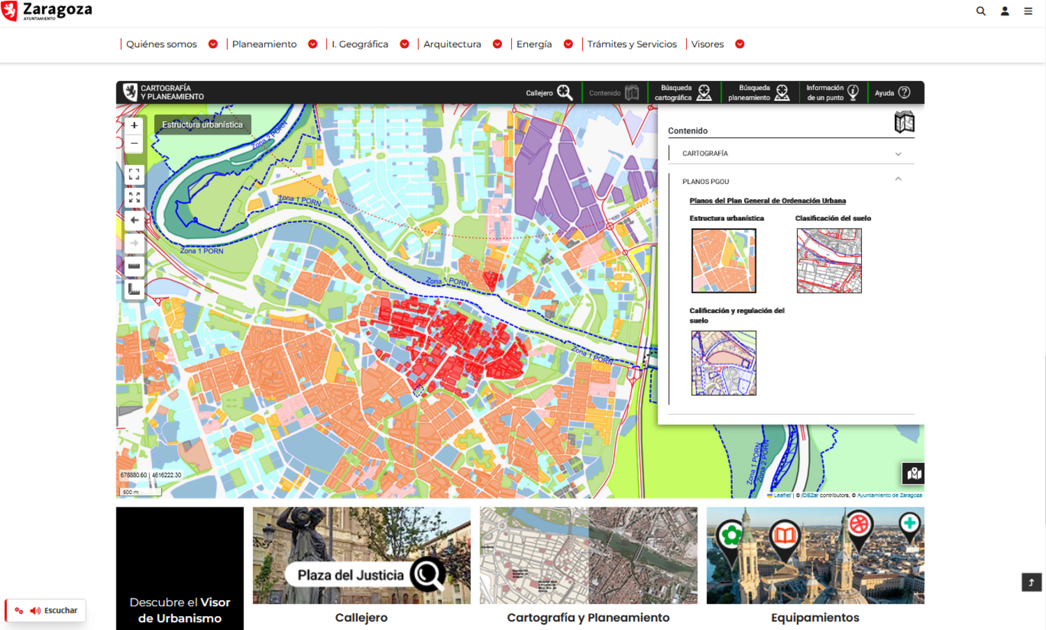
This October, the new urban planning portal of Zaragoza City Council was launched. It was developed under the guidelines of the European INSPIRE Directive, the purpose of which is to facilitate access, exchange and use of public geographic information, promoting better management and transparency and helping to make more informed and sustainable decisions.
This portal, which is located within the electronic headquarters of the City Council: https://www.zaragoza.es/sede/portal/urbanismo/ , and is the result of collaborative and transversal work between different areas of the Zaragoza City Council, has a double objective:
- Facilitate procedures for citizens, offering clear and precise information that allows them to understand the processes to follow and the documents that must be provided. https://www.zaragoza.es/sede/portal/urbanismo/tramites
- Facilitate access to cartographic, planning, registration, plot, historical and street information, among others.
There are different viewers in which the information is displayed:
- Cartography and planning
- Municipal facilities
- Activity licenses
- Urban planning licenses
- Projects and works
- Historical cartography
At Geoslab we have developed both the web portal, using technologies such as Bootstrap, Angular, etc. and following the standards of quality, accessibility and usability of the electronic site, as well as the geographic viewers offered within the urban planning portal space.
These interactive geographic visualization tools are the visible part of a new GIS infrastructure that we have designed and developed on IDEZar (Spatial Data Infrastructure of Zaragoza) following the INSPIRE Directive that favors interoperability and is based entirely on Open Source technologies (QGIS, PostGis, geoserver, geonetwork, etc.).
In the media:
- Urbanismo presenta su nuevo portal digital para facilitar los trámites y mejorar la accesibilidad y la transparencia.
- Zaragoza estrena página web de Urbanismo para facilitar los trámites y la búsqueda de datos.
- La nueva web de Urbanismo de Zaragoza facilitará los trámites e incluye un visor que unifica toda la información.
- Pedir una licencia urbanística es desde hoy más fácil: así es la nueva web de Zaragoza.
- El nuevo espacio web de Urbanismo del Ayuntamiento de Zaragoza facilitará los trámites online.
- El nuevo portal web de Urbanismo facilitará los trámites e incluye un visor que unifica toda la información.
- Zaragoza lanza nuevo portal de Urbanismo con tecnología avanzada y accesible.


